Villa La Angostura lies inside Nahuel Huapi National Park: forests, lakes and mountains a
few minutes from the cabin. Here are the best outings near the village. For the Seven Lakes
Route and full-day trips, see Day trips in the area.
Before you go hiking: on many trails the National Park trekking registration is
mandatory and free (online at nahuelhuapi.gov.ar, or at the information center on the
isthmus). Several trails have no phone signal: tell someone where you’re going and when
you plan to be back.
During the high fire-risk season, only light fires where it’s allowed. Hours, prices and
trail conditions change with the season: check with the Tourism Office
(villalaangosturaturismo.gob.ar) before you go.
Quetrihué Peninsula and the port
Arrayanes Forest
- 🥾 11-12 km one way
- 🚲 Also by bike
- 🎟️ National Park fee
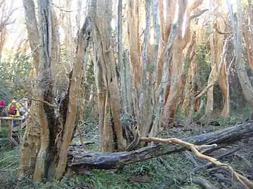
The only arrayán forest in the world you can visit: cinnamon-colored trees up to 25 m tall, some of them several centuries old. The trail starts at the Quetrihué isthmus, next to Bahía Brava. You can go on foot or by bike and come back by boat. In summer, to walk there and back you must start before 2 p.m.
View on map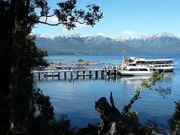
Boat trip to the Arrayanes Forest
- ⛴️ From Bahía Mansa or Bahía Brava
The easiest way to reach the forest: sail across Lake Nahuel Huapi, walk through the forest and sail back. Many people walk there and come back by boat, with a return ticket bought in advance. There is a café and restrooms at the forest.
View on map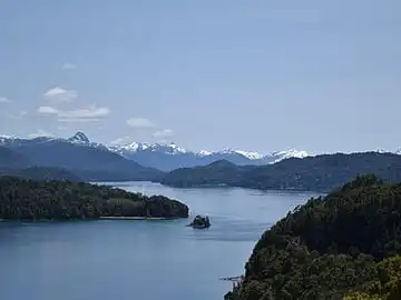
Quetrihué viewpoints
- 🚶 20 min to the first one
From the park ranger office at the isthmus, a short trail with a moderate slope leads to the Brazo Norte viewpoint and, further on, to the Bahía Mansa viewpoint. Views of the lake, the El Messidor residence and Cerro Bayo. Ideal if you don't have time for the forest.
View on map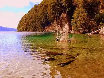
Bahía Mansa and Bahía Brava
- 📍 3 km from downtown
- ♿ Accessible beach at Bahía Brava
The port beaches, on Lake Nahuel Huapi. You can rent bikes, canoes and boats in the area. Bahía Brava has an accessible beach with a walkway, a viewing deck, amphibious chairs and lifeguards.
View on map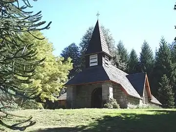
Historic quarter, chapel and museum
- 📍 3 km from downtown
- 🎧 9-stop audio guide
Where the village began. The Nuestra Señora de la Asunción chapel (1936) was designed by Alejandro Bustillo, and Hotel Angostura (1938) was the first National Parks hotel. The Municipal History Museum, in the old power plant, keeps a canoe carved from a single coihue trunk.
View on map🌿Laguna Verde
- 📍 2.5 km from downtown
- 📅 All year
A nature reserve 500 m from the chapel, with a trail around the lagoon among cypresses, coihues and espino azul. There you'll find the "Arrayán del Amor", a cypress and an arrayán that grew together.
View on map🧶Artisan and local producer markets
Two markets to buy from local artisans and producers: the Terminal market, downtown, and the Port market, in the historic quarter. Knitwear, ceramics, fused glass, silverwork, preserves and liqueurs.
View on mapWaterfalls, rivers and trails near the village
Belvedere viewpoint and Inacayal waterfall
- 🥾 About 5 km round trip
- Moderate
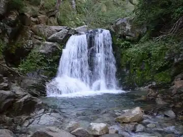
A local classic. The trail climbs through the forest and splits: one branch goes to the Belvedere viewpoint, overlooking the lakes, and the other to the Inacayal waterfall, a drop of about 50 m. It's about 30 minutes from the viewpoint to the waterfall.
View on map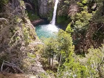
Río Bonito waterfall
- 🚶 200 m, about 30 min
- 📍 On the road to Cerro Bayo
A 20 m drop of emerald-green water over volcanic rock, seen from a natural balcony. The access is on the road to the ski resort, 1 km before the parking lot. On foot only.
View on map🏞️Río Bonito trail
- 🚶 1.5 km
- 👨👩👧 Good with kids
An easy walk along the Río Bonito to where it flows into Lake Nahuel Huapi, with places to rest. It starts next to the Fundación Salmónidos building. Also nice for a run.
View on map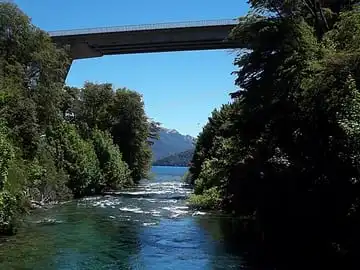
Río Correntoso
It joins Lake Correntoso and Lake Nahuel Huapi in only about 200 m. From the bridge you can see both lakes, and it's one of the most famous fly-fishing spots. The beach area has a waterfront on Lake Correntoso.
View on map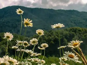
Brazo Última Esperanza trail
- 🥾 2 h round trip
- Easy to moderate
- 🚲 Bike-friendly
It starts at km 4 of route 231 and ends at a beach on Lake Nahuel Huapi. Open all year, no guide needed. Little phone signal.
View on map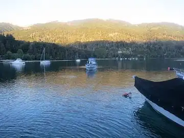
Puerto Manzano bay
A neighborhood on a bay with small sandy beaches between rocks: the eastern ones get the morning sun and the western ones, the afternoon sun.
View on mapMountain and adventure
Cerro Bayo
- ⛷️ Skiing in winter
- 🚵 Bike park in summer
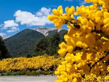
The local ski resort, with its base at 1,050 m. In winter: skiing, snowboarding, sleds and snowshoe walks. In summer (January to April): zip line over the Río Bonito, bike park (advanced trails only), paragliding and mountain-top dining. Dates and hours at cerrobayo.com.ar.
View on map🎣Fly fishing
- 📅 Season from November 1
- 📝 License required
The rivers and lakes of the area are famous for sport fishing, especially the Río Correntoso. Licenses are sold on the Neuquén Caza y Pesca website (cazaypesca.neuquen.gob.ar). Check the regulations before you go.
⛰️Peaks for experienced hikers
- 📅 December to March
- 📝 Trekking registration
Filo del Falso Belvedere: 3 h one way and 726 m of climbing, with views of Lakes Correntoso and Nahuel Huapi (a guide is recommended). Cerro O'Connor: 4 h one way and 1,000 m of climbing, with views of Mount Tronador. Both are demanding hikes.
View on map


